What is a LiDAR survey?
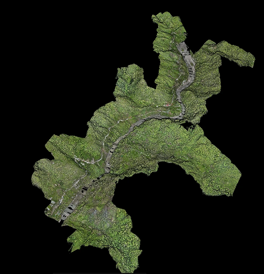
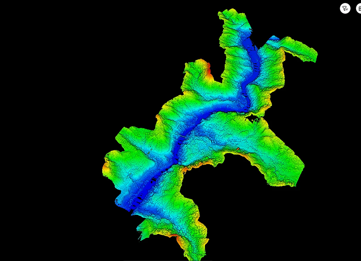
A LiDAR survey uses a laser scanner — mounted on a UAV — that fires hundreds of thousands of pulses per second and measures their return time. The result is a dense 3D point cloud of the terrain and everything on it, accurate to centimetres, from which DEMs, contours and drawings are extracted.
Why use LiDAR instead of drone photogrammetry?
Photogrammetry only sees what the camera sees — in dense forest it maps the canopy, not the ground. LiDAR pulses penetrate gaps in vegetation and return from the actual terrain, making it the only practical way to get accurate bare-earth models under forest cover.
What accuracy does UAV LiDAR achieve?
With RTK/PPK trajectory processing and ground-control verification, typically 5–10 cm vertical accuracy on bare ground. Every HSSPL deliverable is independently checked against DGPS control points before handover.
What deliverables do we receive?
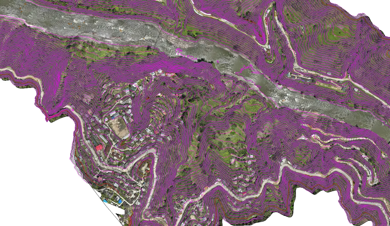
Classified LAS/LAZ point clouds, bare-earth DEM/DTM rasters, contour plans at your specified interval, cross-sections and L-sections, GIS-ready shapefiles, CAD drawings (DWG/DXF) and a survey report with accuracy statement.
How large an area can be covered?
Roughly 1–3 sq km per flying day depending on terrain and point density; corridor projects progress 10–20 km per day in favourable conditions.